SAN FRANCISCO 2047 / ROUND 24 REFERENCE REVIEW
More depth.
More believable waterfronts.
31 images found: six adjacent full frames and a curated packet of 25 hero, architectural, canal, skyline and atmosphere views. The next pass should begin with a connected waterfront block: recessed facades, visible occupied rooms, working docks, material variation and water contact.
Next-round detail guidePriority reference boardSix adjacent full framesNative model omitted from this web edition.
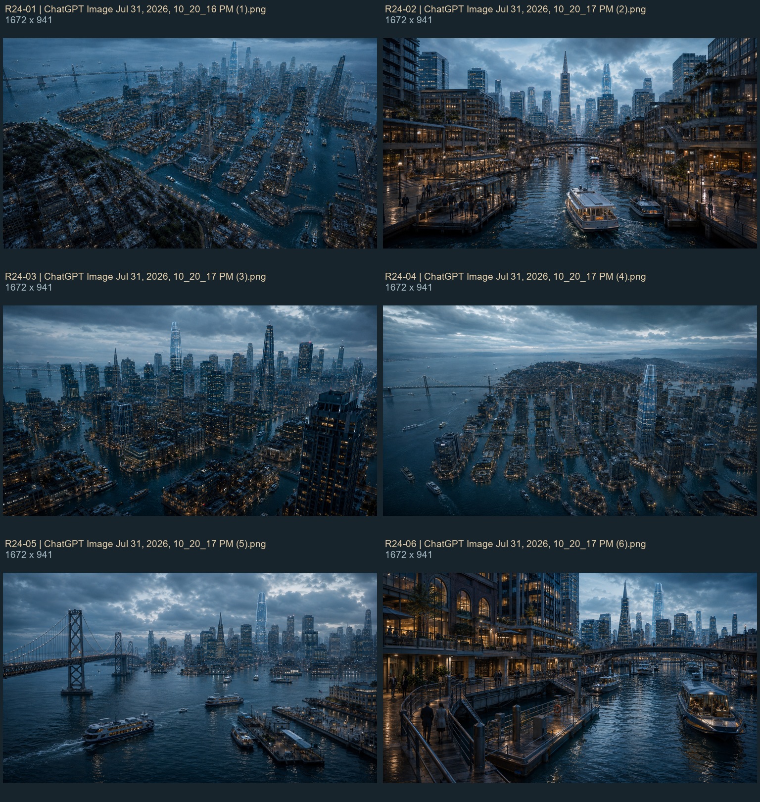
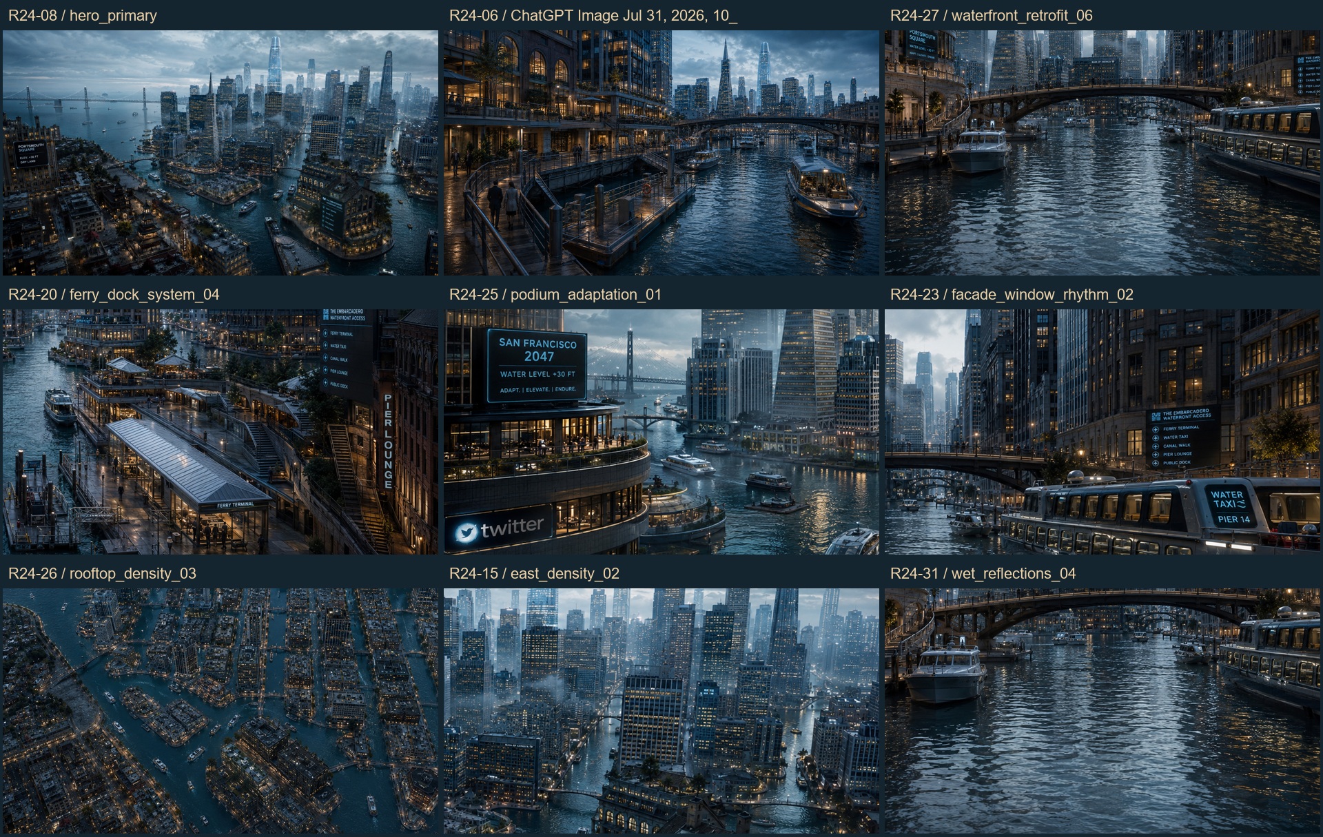
Keep the current dusk lighting and scene layout. The storm mood is deferred atmosphere guidance. These references primarily support the city's architecture, public realm, water and vehicles; they add no close-up face, food or drone construction reference.
The packet declares six parent images with different filenames. Their relationship to the six adjacent PNGs is not established, and visual differences prevent treating them as simple verified crops. The packet's 4K hero and 1080p supporting views are declared upscales/crops, not newly captured detail. The ZIP exactly duplicates the extracted packet.
Recommended order
Browse the batch
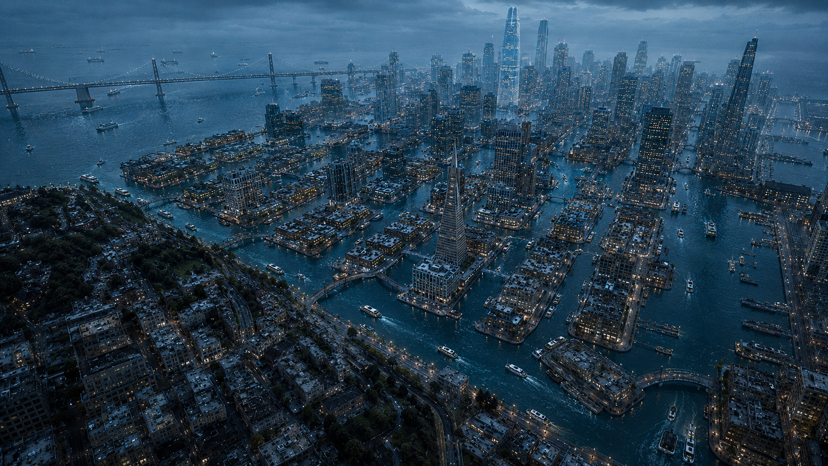
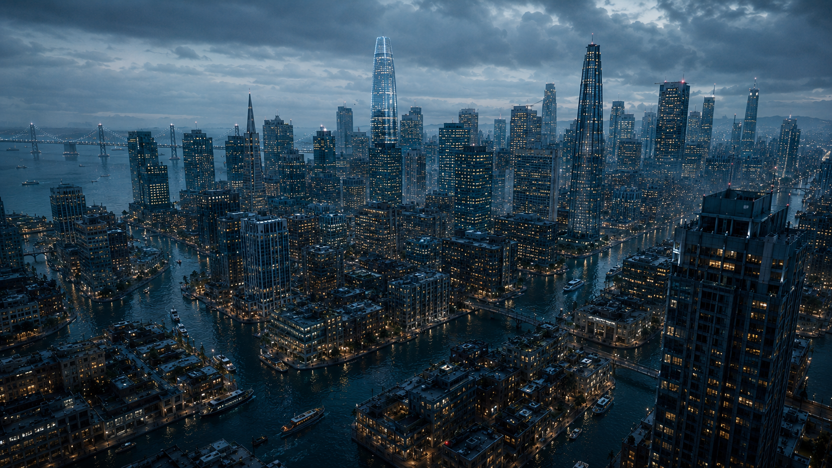
R24-01 / Full frame 01
1672 × 941 · Separate supplied frame
Supplied city-scale image. Use for overall architecture, waterfront composition and depth.
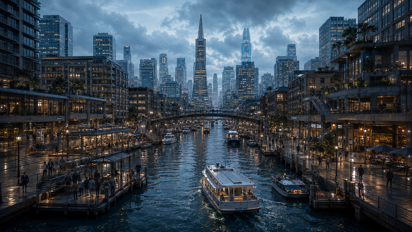
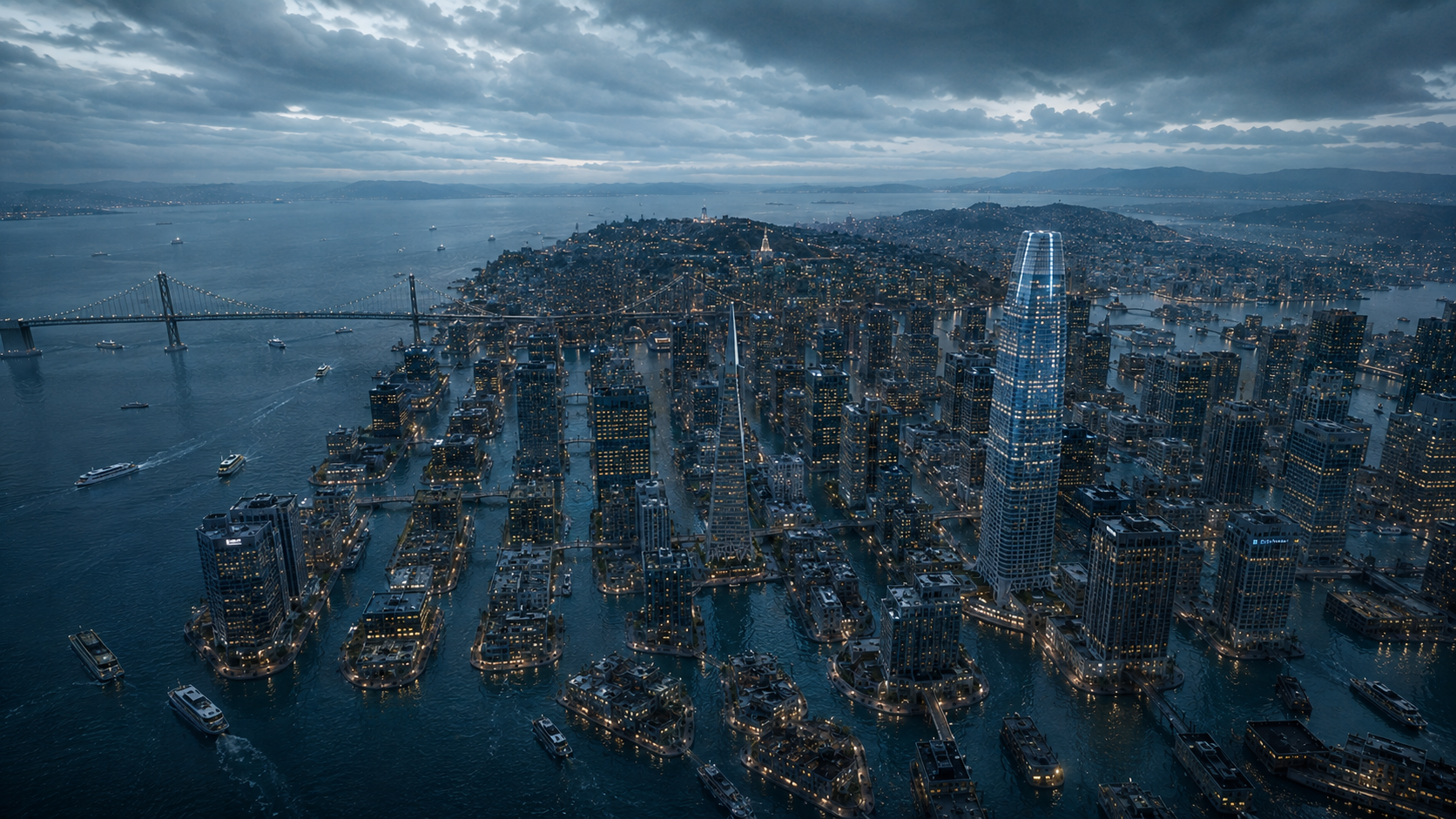
R24-02 / Full frame 02
1672 × 941 · Separate supplied frame
Supplied city-scale image. Use for overall architecture, waterfront composition and depth.
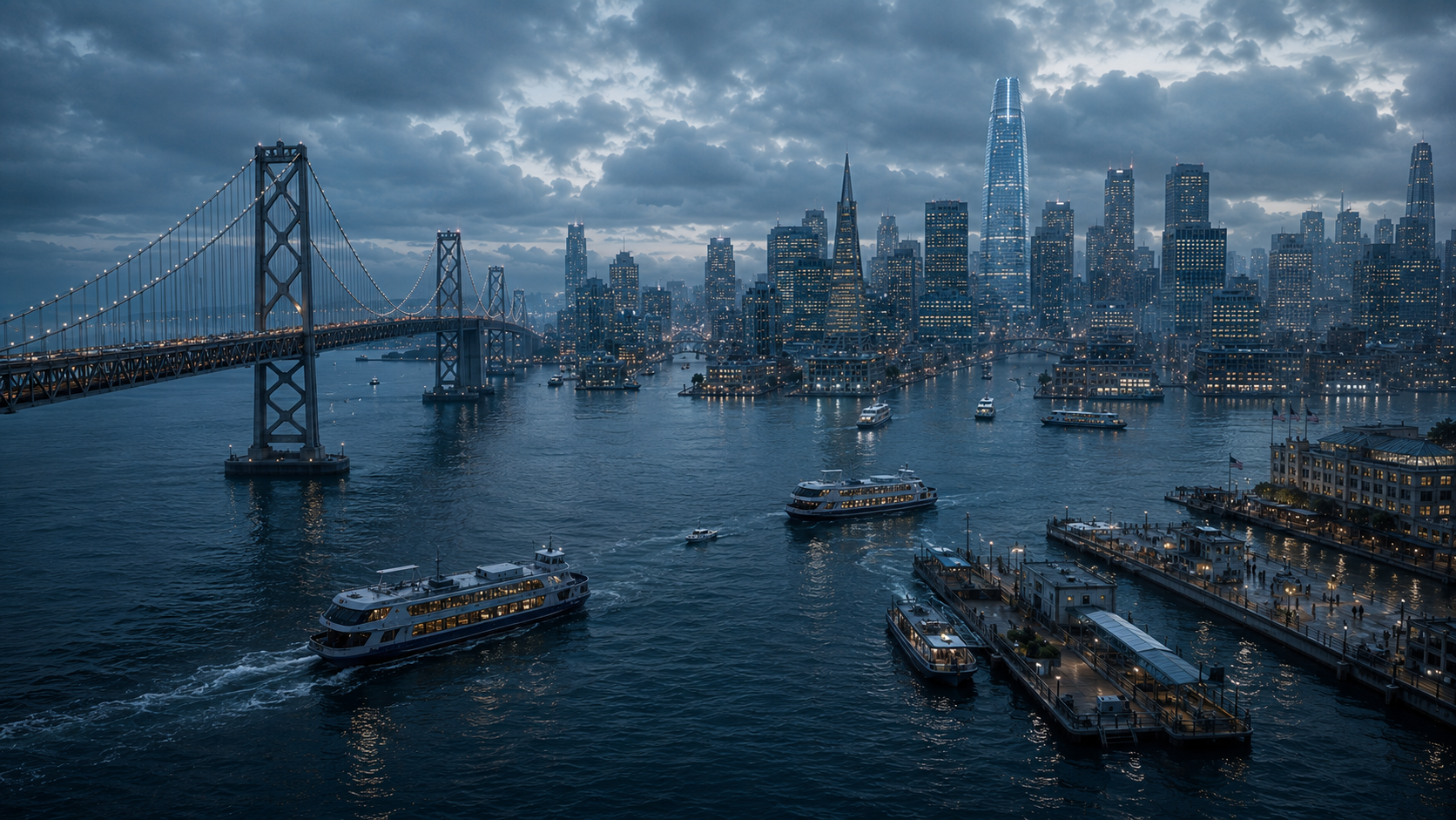
R24-03 / Full frame 03
1672 × 941 · Separate supplied frame
Supplied city-scale image. Use for overall architecture, waterfront composition and depth.
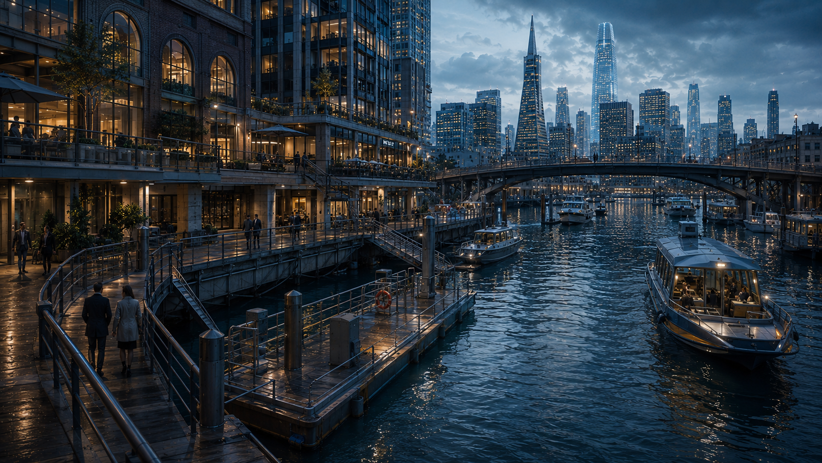
R24-04 / Full frame 04
1672 × 941 · Separate supplied frame
Supplied city-scale image. Use for overall architecture, waterfront composition and depth.
R24-05 / Full frame 05
1672 × 941 · Separate supplied frame
Supplied city-scale image. Use for overall architecture, waterfront composition and depth.
R24-06 / Full frame 06
1672 × 941 · Separate supplied frame
Supplied city-scale image. Use for overall architecture, waterfront composition and depth.
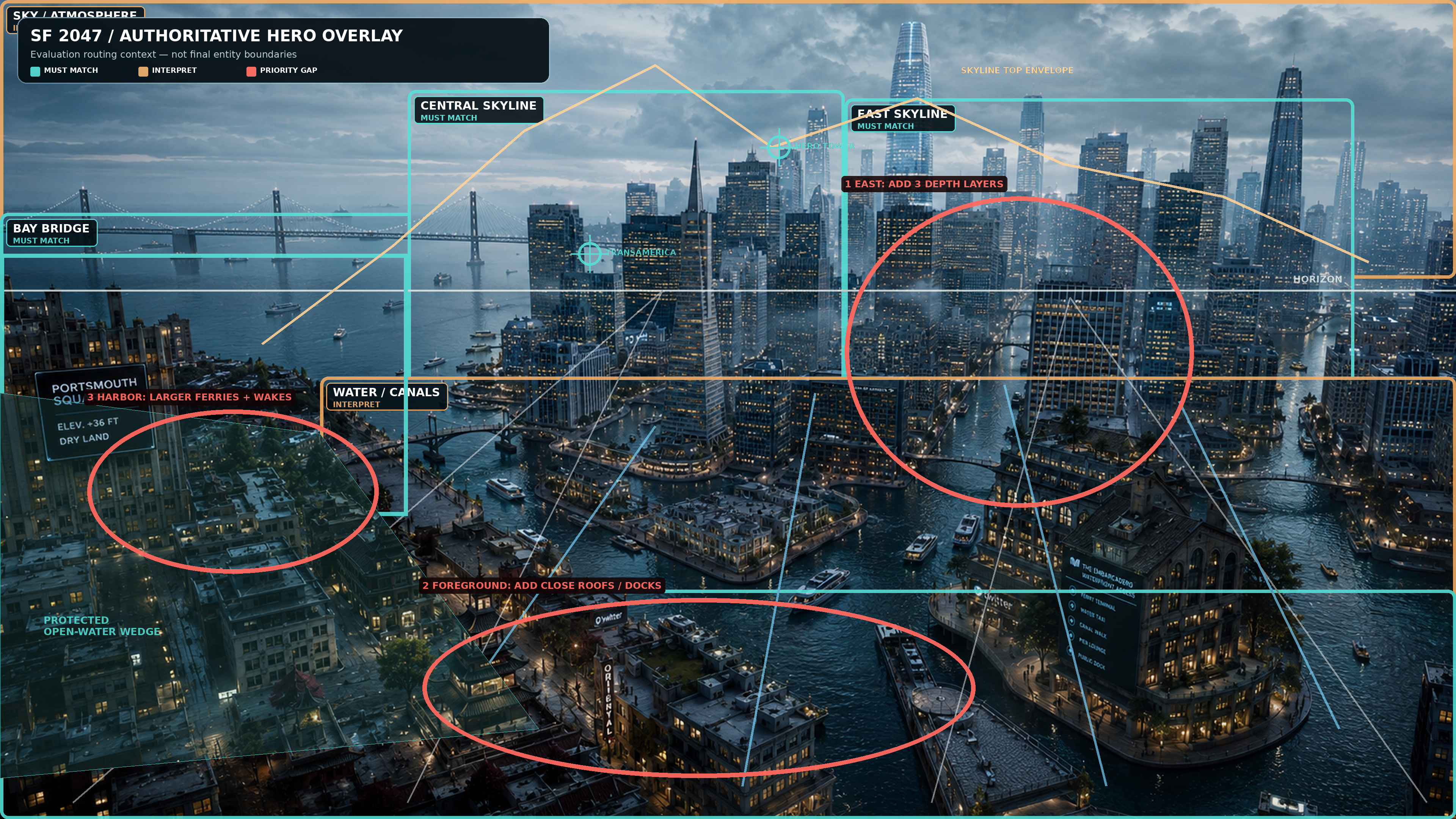
R24-07 / hero_annotated.jpg
3840 × 2160 · annotated overlay
explicit zones, horizon, vanishing directions, skyline envelope, canal axes, focal centers and protected open-water wedge
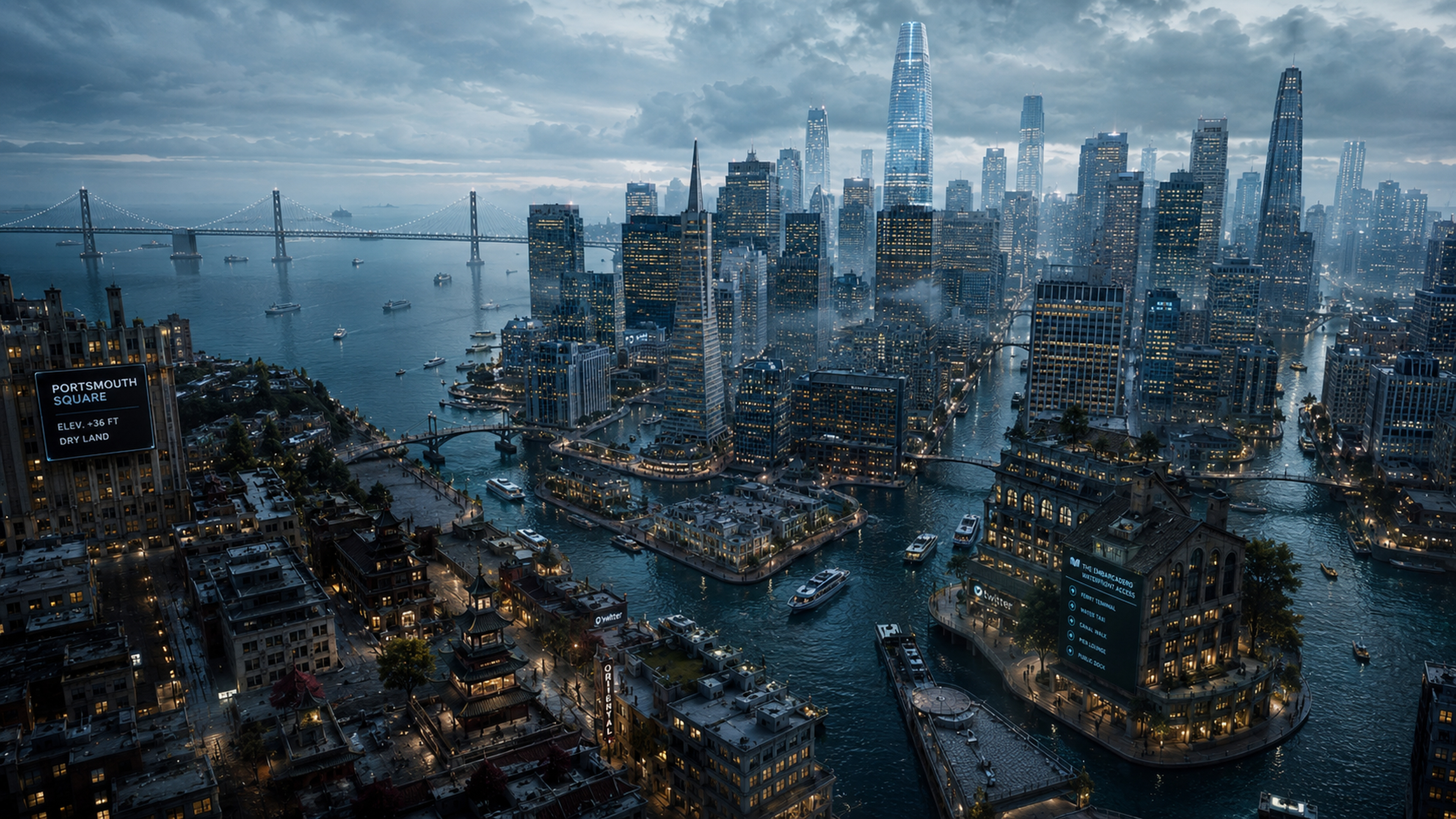
R24-08 / hero_primary.jpg
3840 × 2160 · upscaled to 3840x2160; no new source detail claimed
authoritative composition, bridge placement, landmark hierarchy, storm-water palette and protected open-water wedge
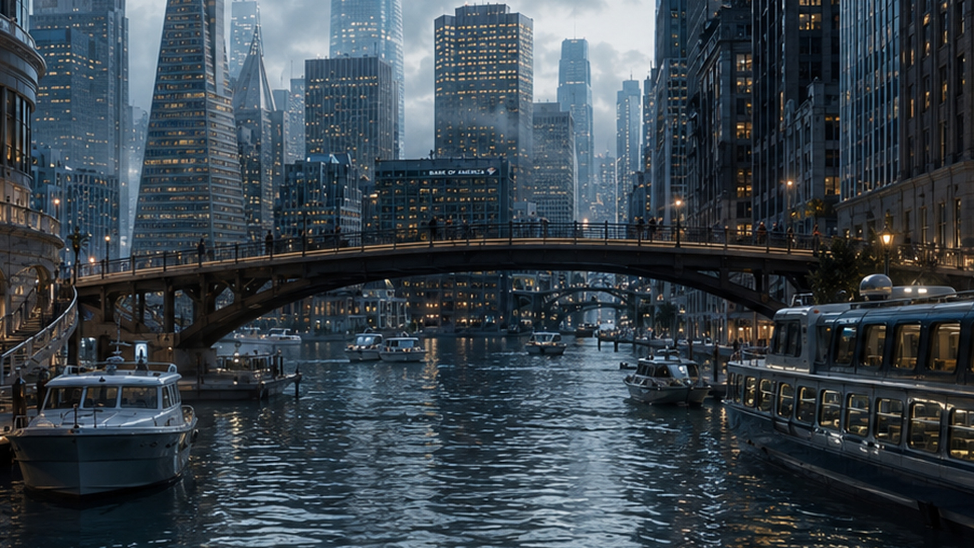
R24-09 / bridge_canal_span_03.jpg
1920 × 1080 · targeted 16:9 crop, resized to 1920x1080
pedestrian-scale arched span with readable deck and water clearance
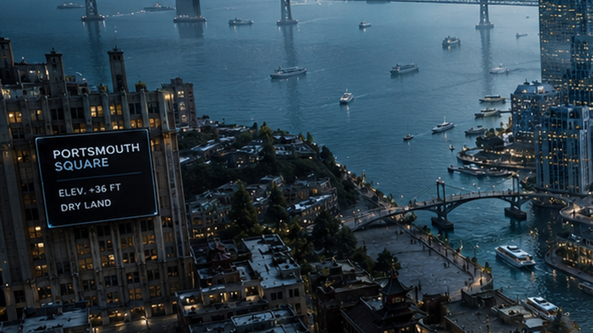
R24-10 / bridge_context_three_quarter_02.jpg
1920 × 1080 · targeted 16:9 crop, resized to 1920x1080
bridge reads as part of the harbor composition rather than a detached prop
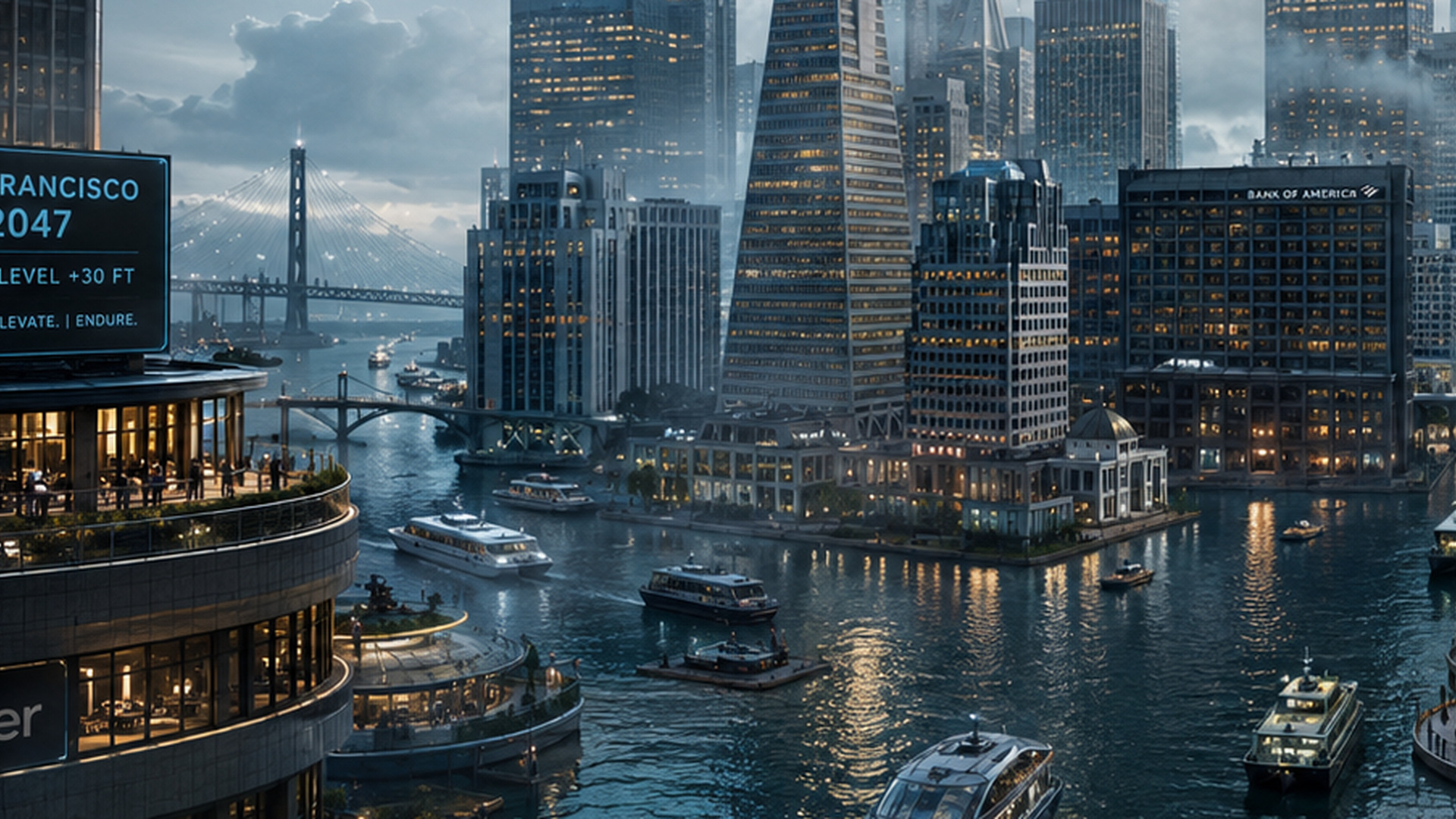
R24-11 / bridge_deck_clearance_04.jpg
1920 × 1080 · targeted 16:9 crop, resized to 1920x1080
layered bridge approaches, railings, stairs and waterside access
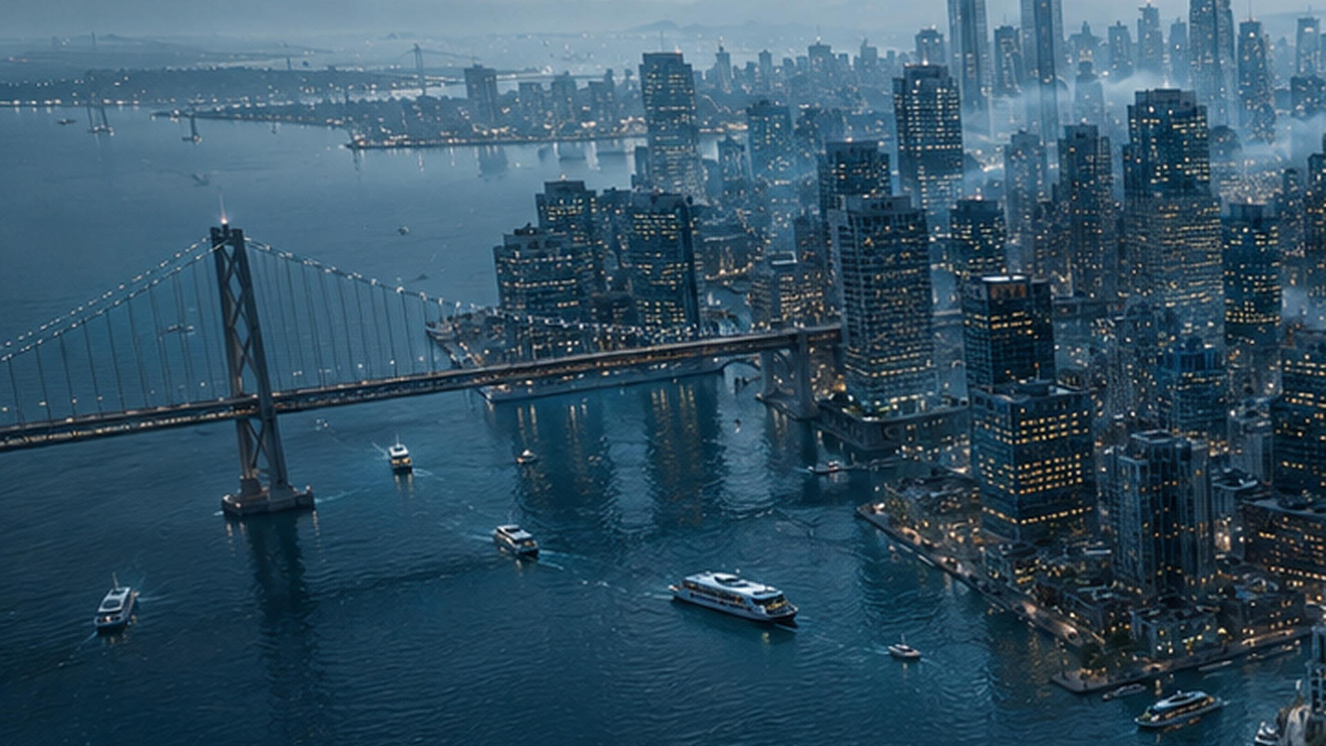
R24-12 / bridge_wide_silhouette_01.jpg
1920 × 1080 · targeted 16:9 crop, resized to 1920x1080
recognizable Bay Bridge silhouette, open-water approach and skyline relationship
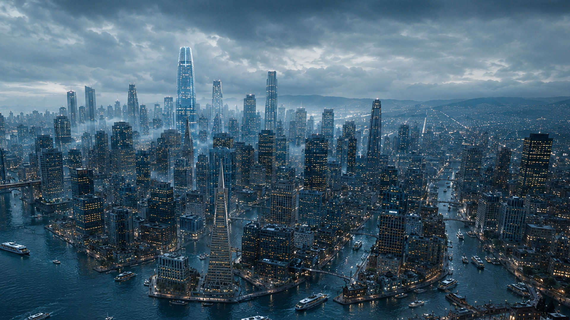
R24-13 / aerial_depth_layers_03.jpg
1920 × 1080 · targeted 16:9 crop, resized to 1920x1080
clear foreground, middle and background skyline bands
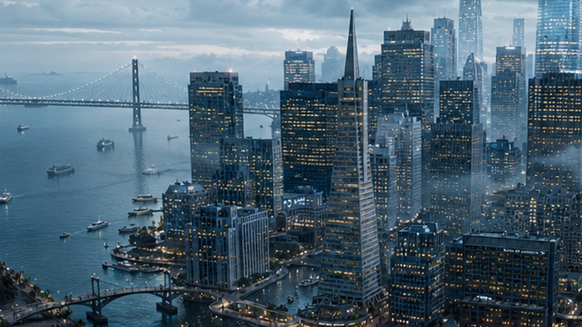
R24-14 / central_hierarchy_01.jpg
1920 × 1080 · targeted 16:9 crop, resized to 1920x1080
Transamerica and hero tower remain legible inside staggered surrounding density
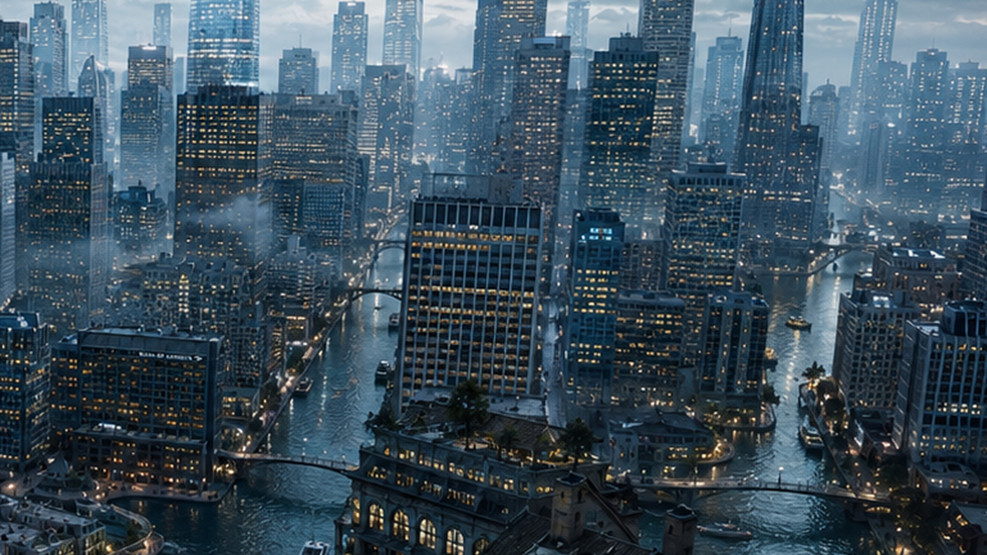
R24-15 / east_density_02.jpg
1920 × 1080 · targeted 16:9 crop, resized to 1920x1080
continuous mixed-height fabric, occlusion and irregular roofline depth
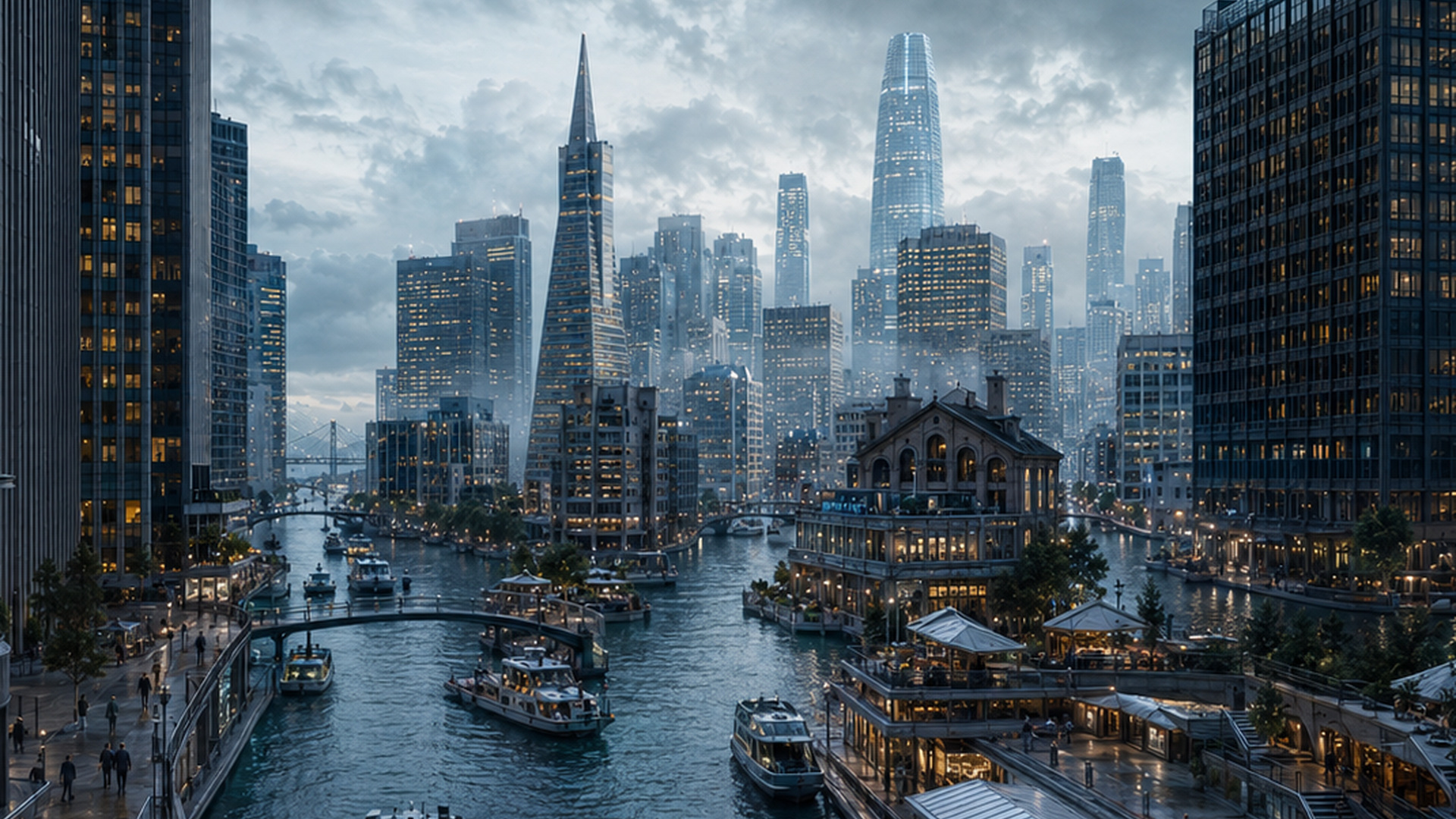
R24-16 / lower_angle_landmarks_04.jpg
1920 × 1080 · targeted 16:9 crop, resized to 1920x1080
landmarks recognizable from canal level with podiums and mid-rises preserving scale
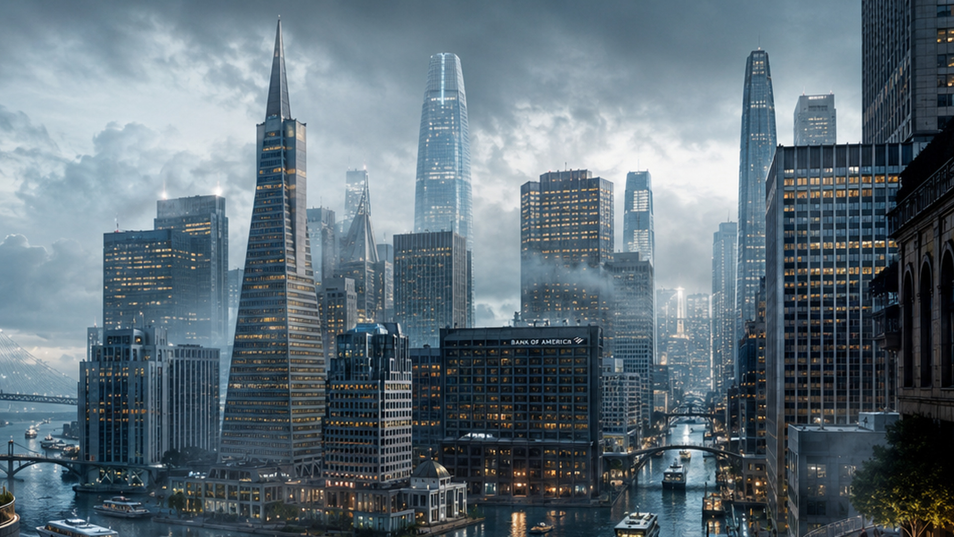
R24-17 / roofline_layers_05.jpg
1920 × 1080 · targeted 16:9 crop, resized to 1920x1080
rooflines overlap in irregular bands with atmospheric separation
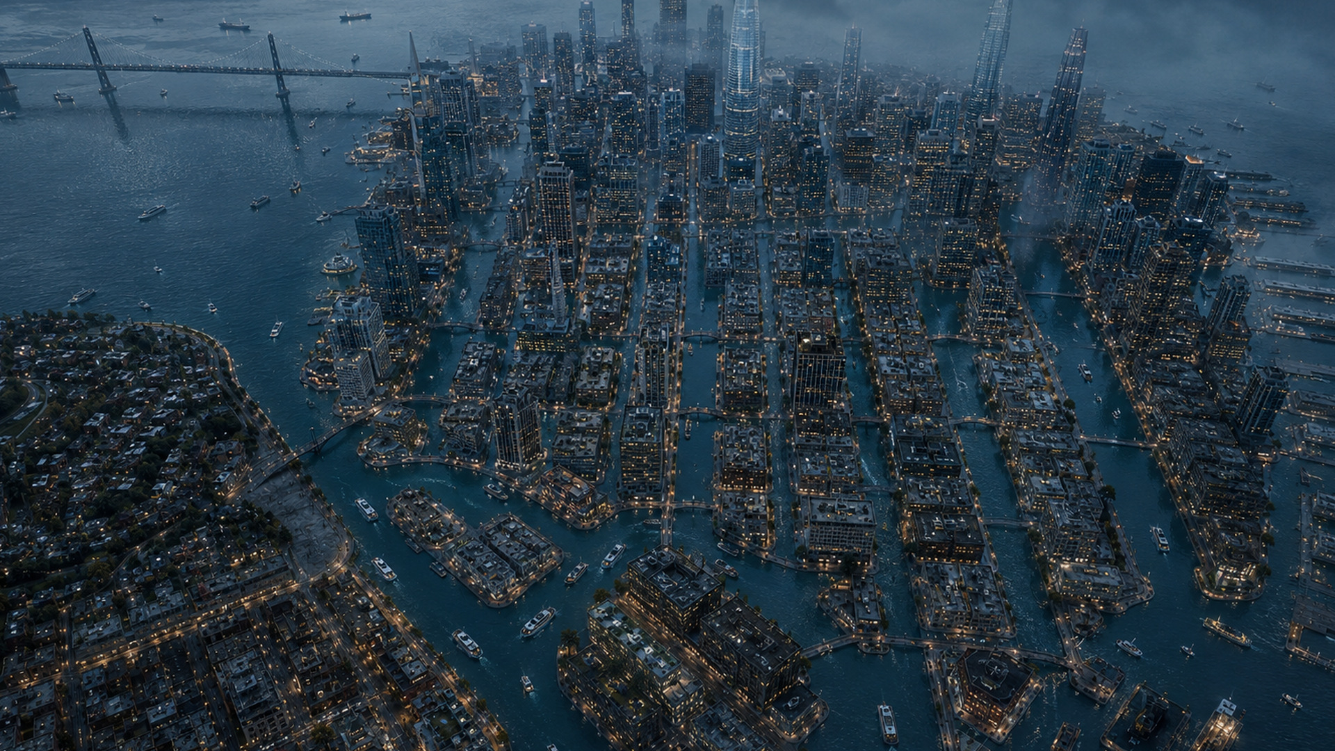
R24-18 / canal_grid_plan_01.jpg
1920 × 1080 · targeted 16:9 crop, resized to 1920x1080
navigable canal grid with connected routes, block islands and clear bay outlets
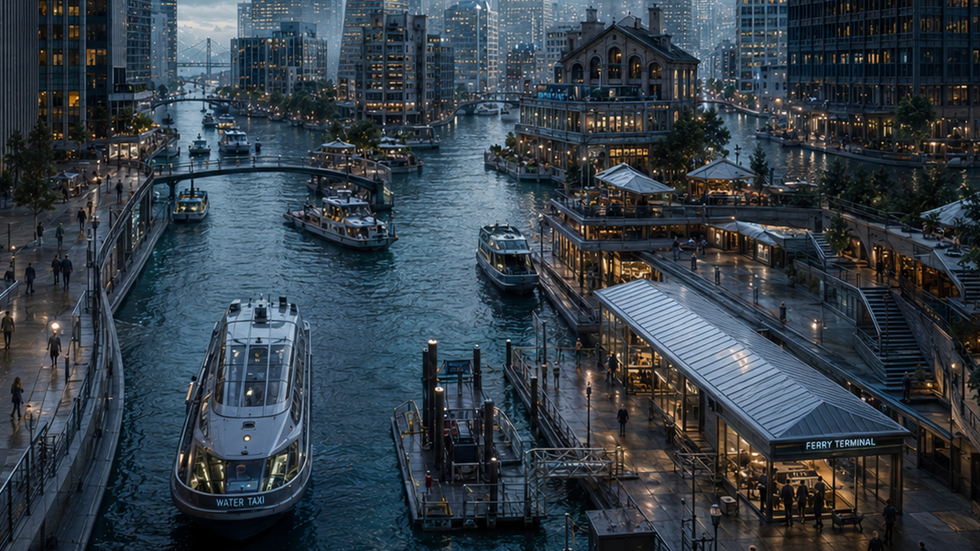
R24-19 / canal_junction_03.jpg
1920 × 1080 · targeted 16:9 crop, resized to 1920x1080
working canal junction with promenades, bridges and service edges
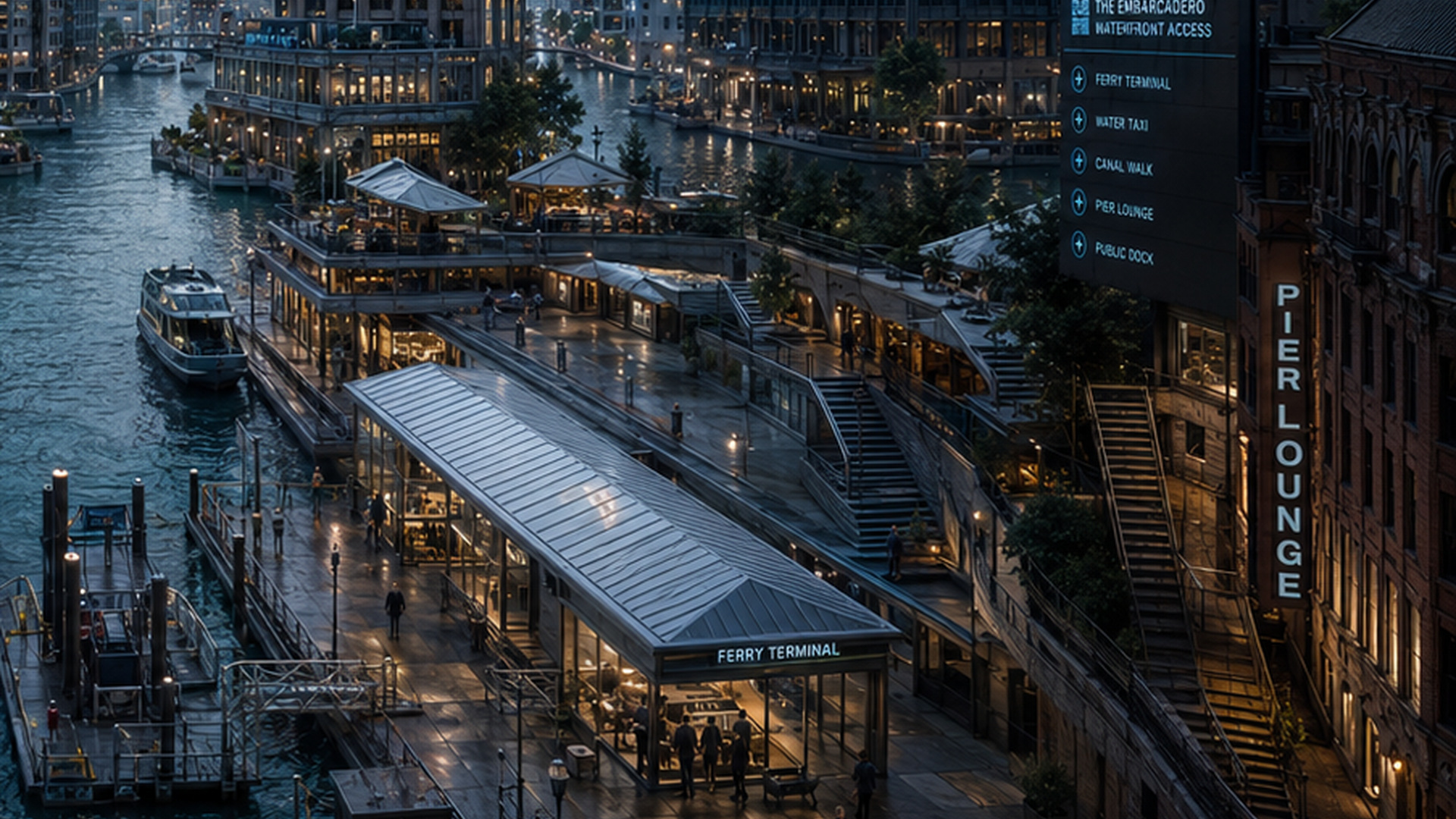
R24-20 / ferry_dock_system_04.jpg
1920 × 1080 · targeted 16:9 crop, resized to 1920x1080
ferry terminal, gangway, floating dock and pedestrian access read as one system
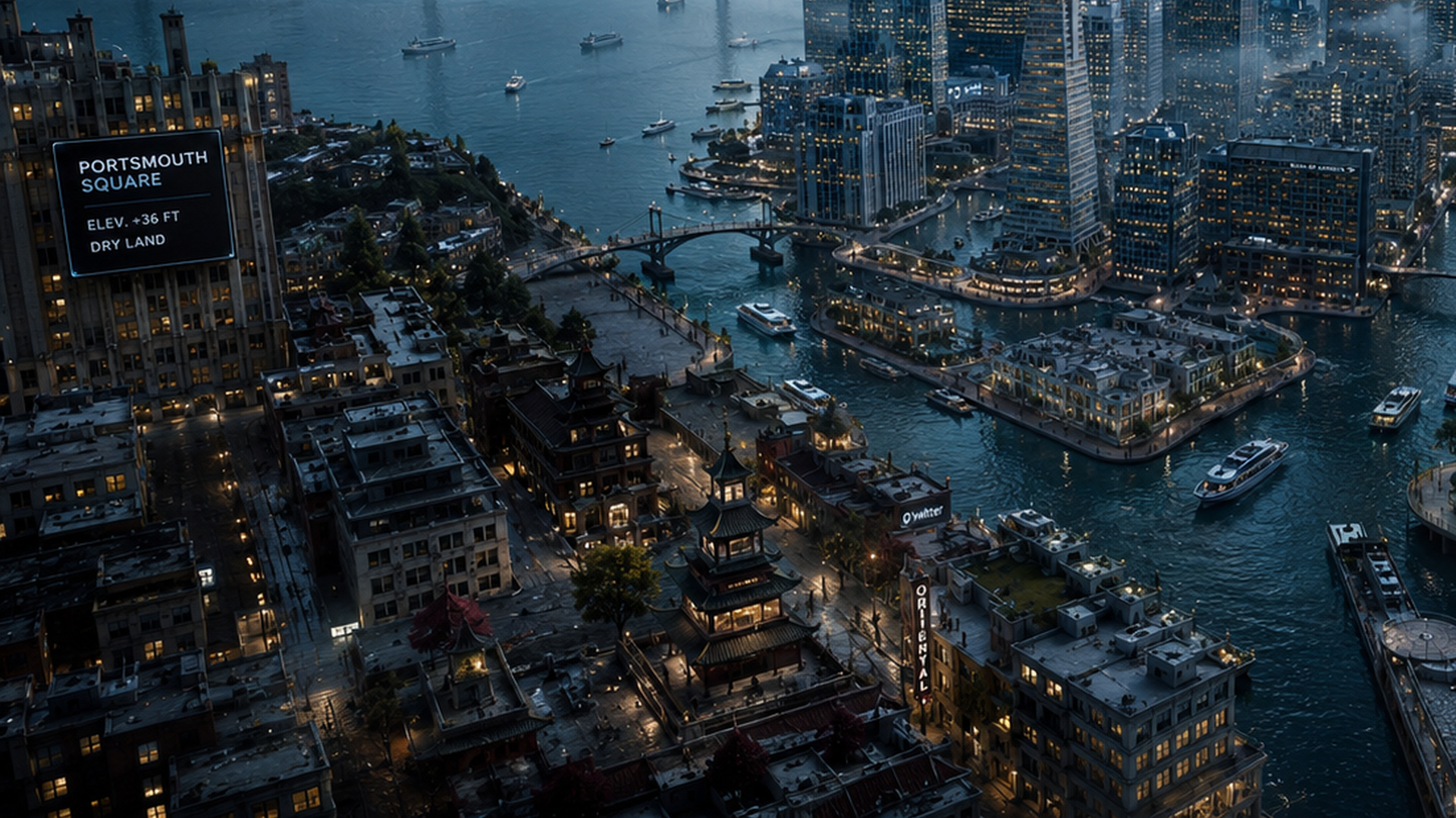
R24-21 / shoreline_transition_02.jpg
1920 × 1080 · targeted 16:9 crop, resized to 1920x1080
clear transition from higher dry ground to inundated financial blocks
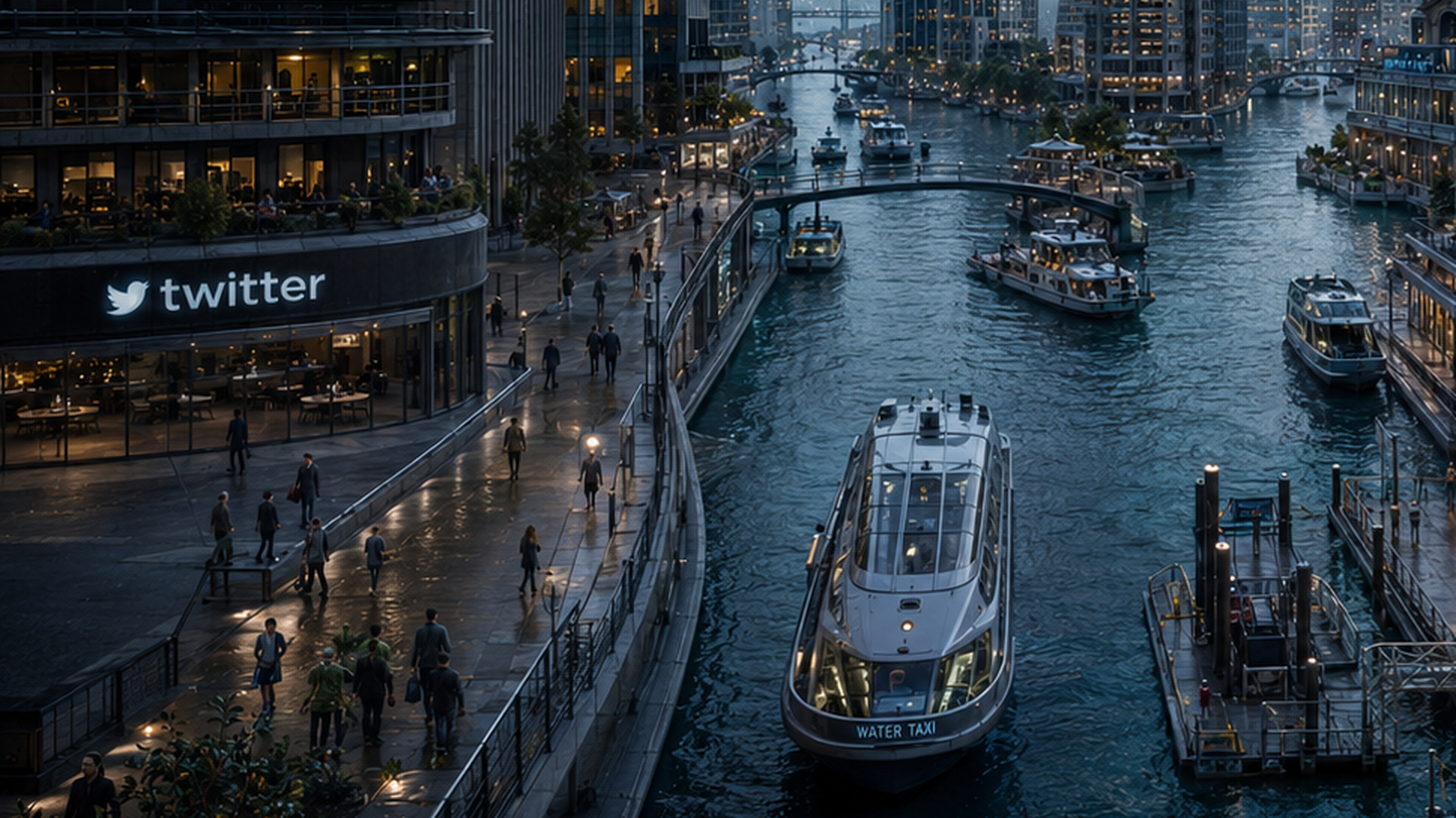
R24-22 / elevated_walkway_05.jpg
1920 × 1080 · targeted 16:9 crop, resized to 1920x1080
elevated promenades, railings and multiple vertical access points
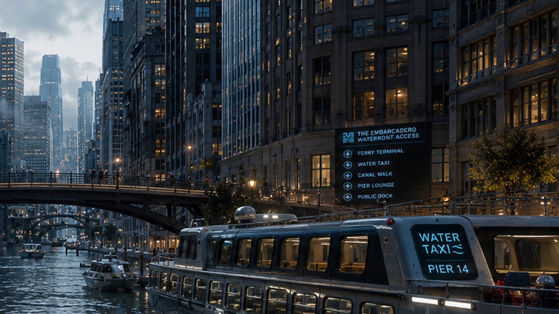
R24-23 / facade_window_rhythm_02.jpg
1920 × 1080 · targeted 16:9 crop, resized to 1920x1080
varied window rhythm, warm occupancy and vertical facade depth
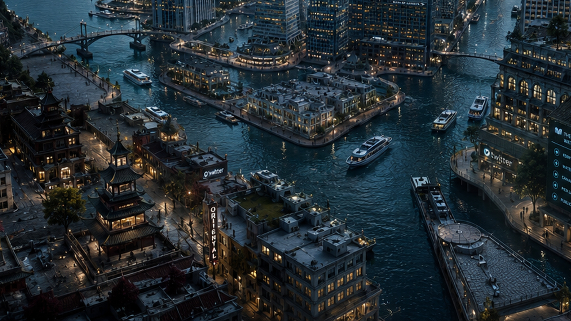
R24-24 / mixed_height_fabric_04.jpg
1920 × 1080 · targeted 16:9 crop, resized to 1920x1080
short, medium and tall buildings overlap continuously into the foreground
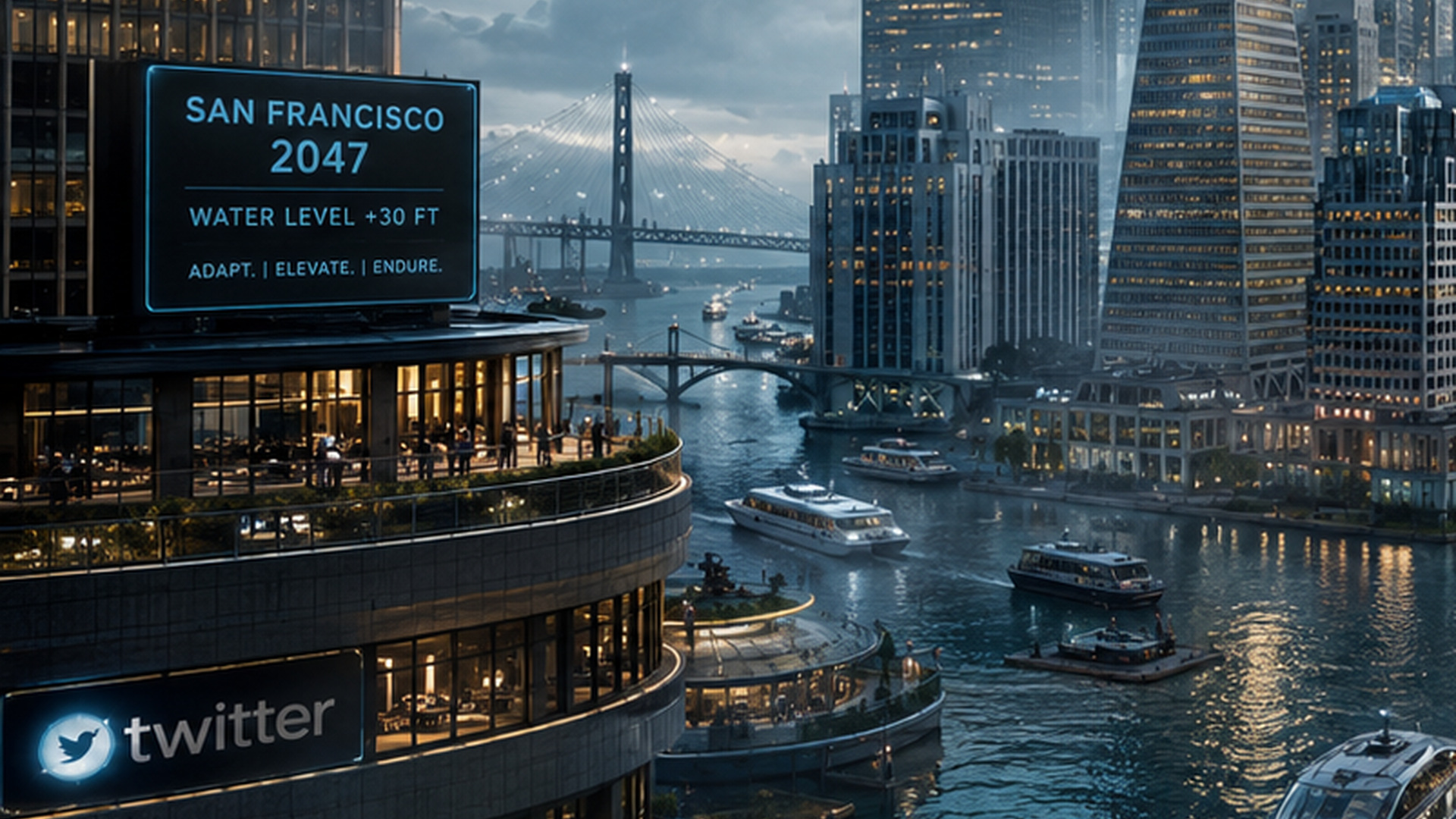
R24-25 / podium_adaptation_01.jpg
1920 × 1080 · targeted 16:9 crop, resized to 1920x1080
historic and modern podiums adapted with terraces, stairs and protected entries
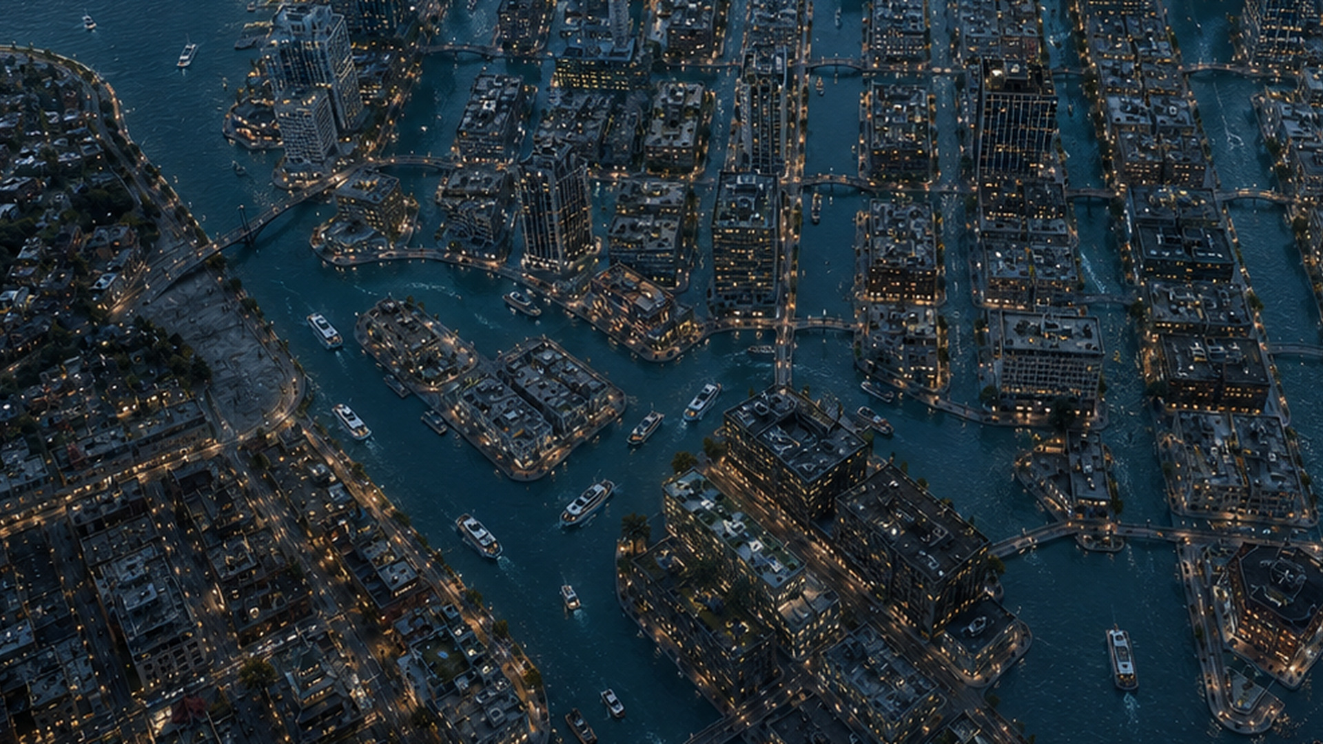
R24-26 / rooftop_density_03.jpg
1920 × 1080 · targeted 16:9 crop, resized to 1920x1080
dense roofscape with parapets, mechanical zones, terraces and irregular setbacks
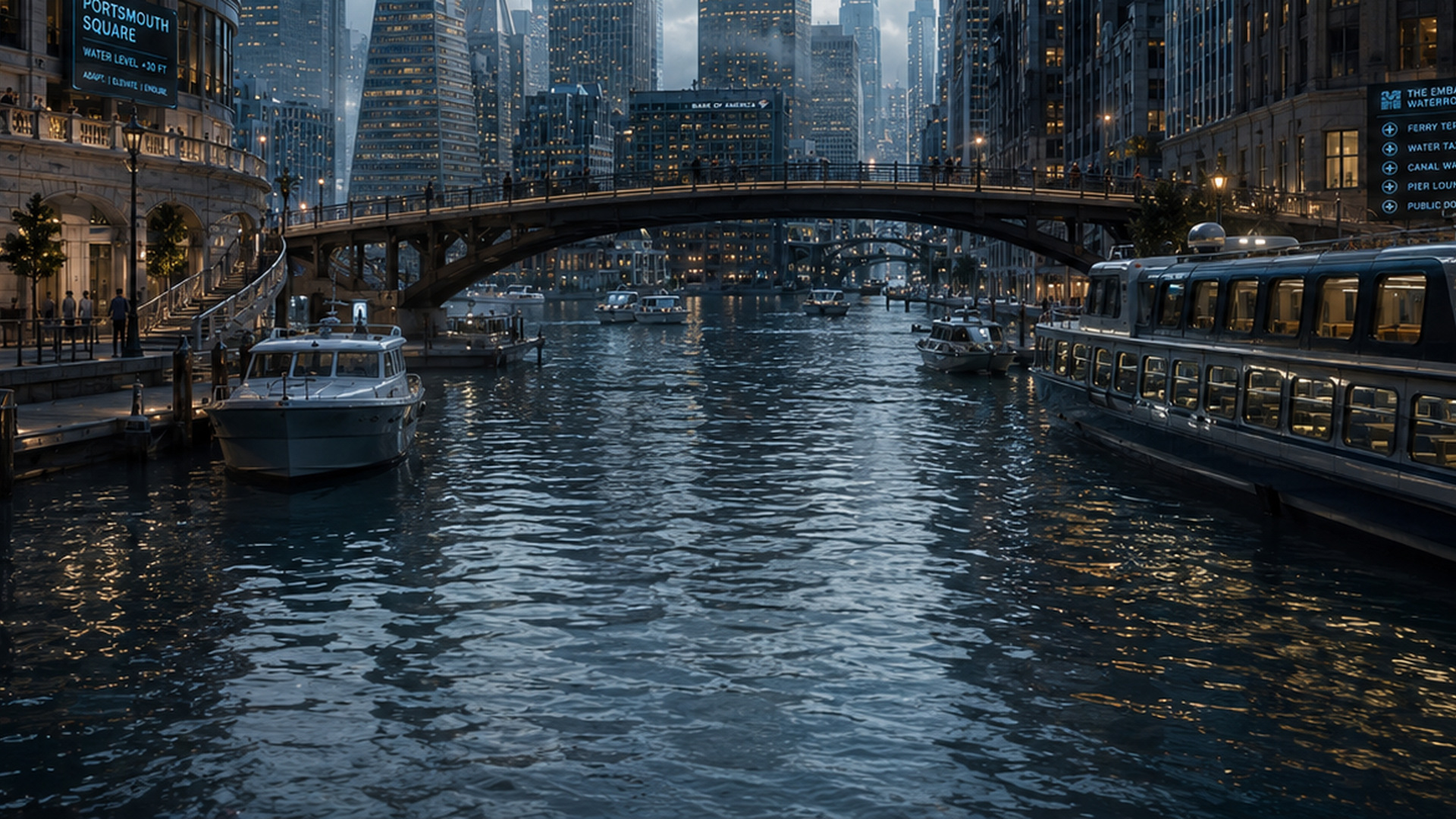
R24-27 / waterfront_retrofit_06.jpg
1920 × 1080 · targeted 16:9 crop, resized to 1920x1080
waterline, moorings, dock edges, bridge undersides and occupied building bases
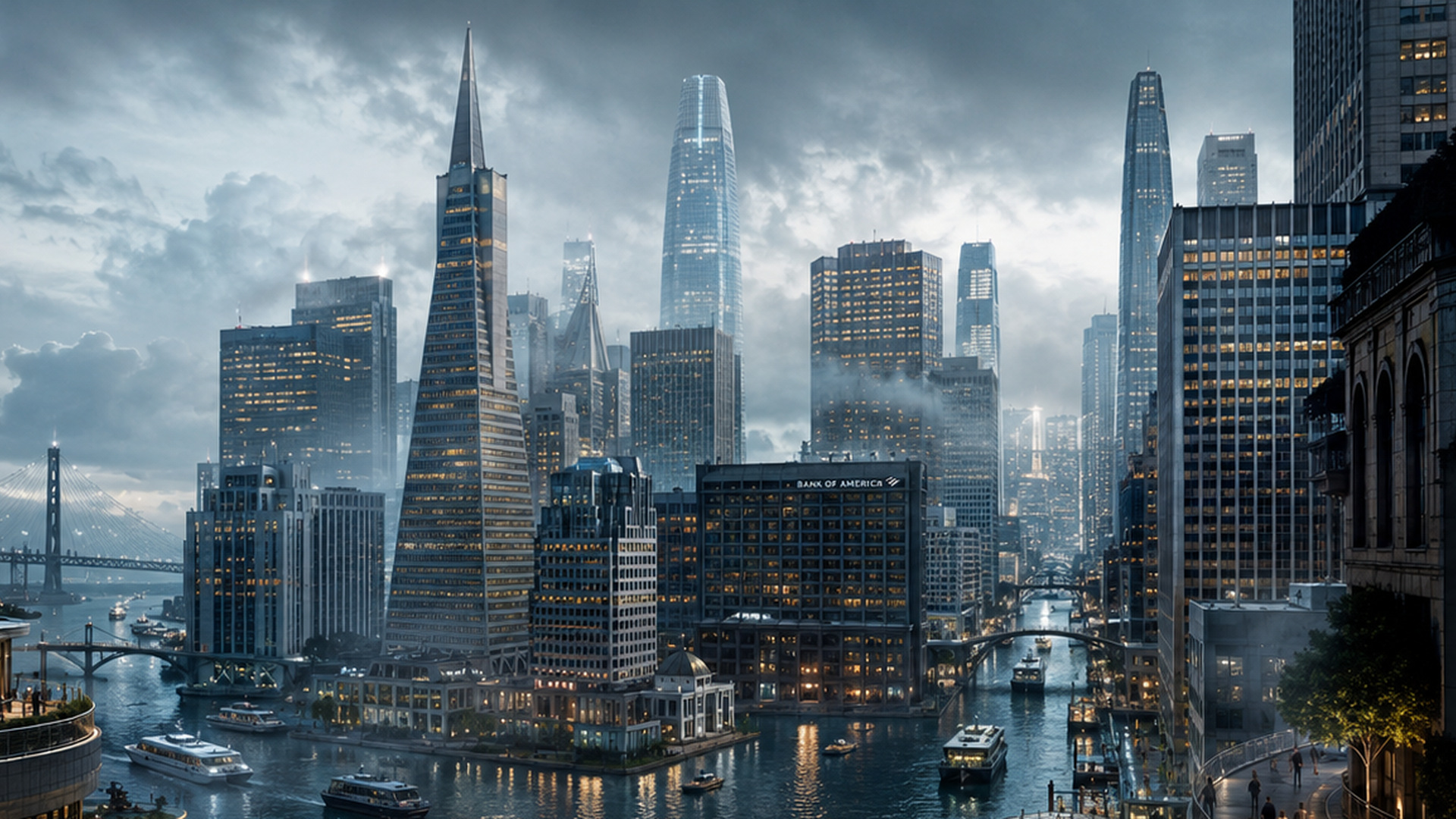
R24-28 / fog_depth_03.jpg
1920 × 1080 · targeted 16:9 crop, resized to 1920x1080
distance fog separates depth bands without erasing architecture
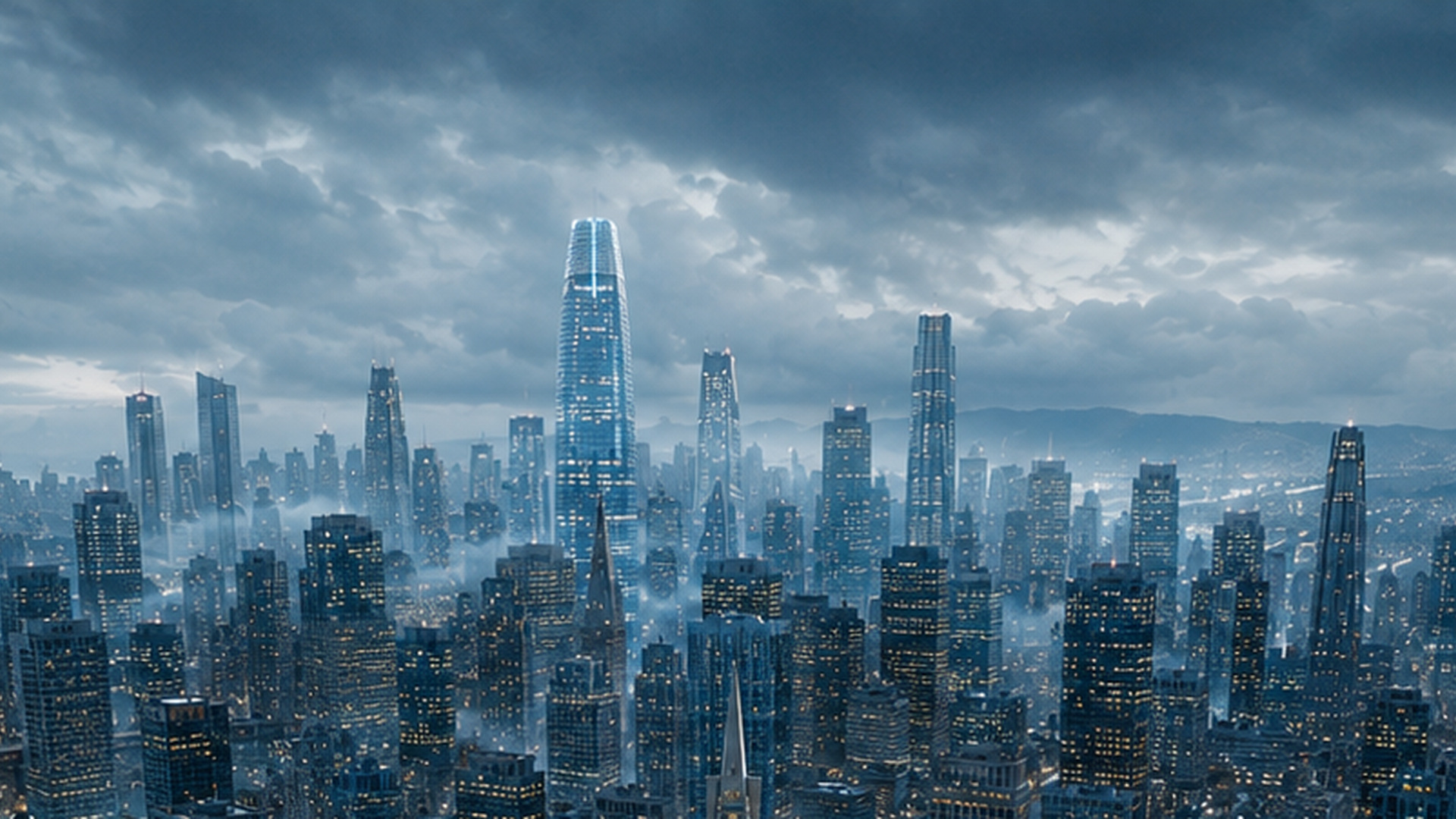
R24-29 / horizon_break_02.jpg
1920 × 1080 · targeted 16:9 crop, resized to 1920x1080
localized bright horizon break behind the skyline
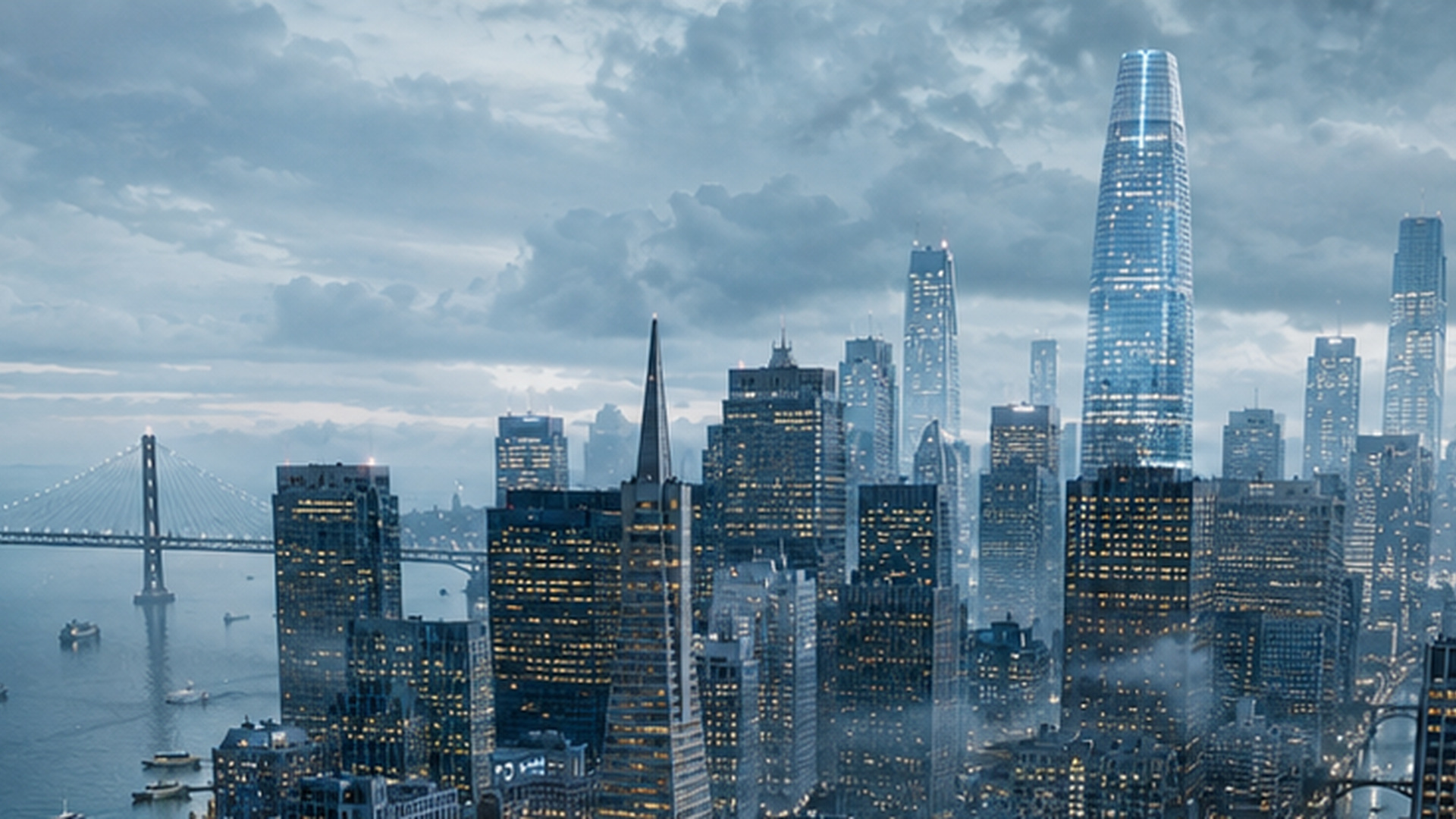
R24-30 / storm_cloud_scale_01.jpg
1920 × 1080 · targeted 16:9 crop, resized to 1920x1080
broad layered storm cloud field with dark upper frame
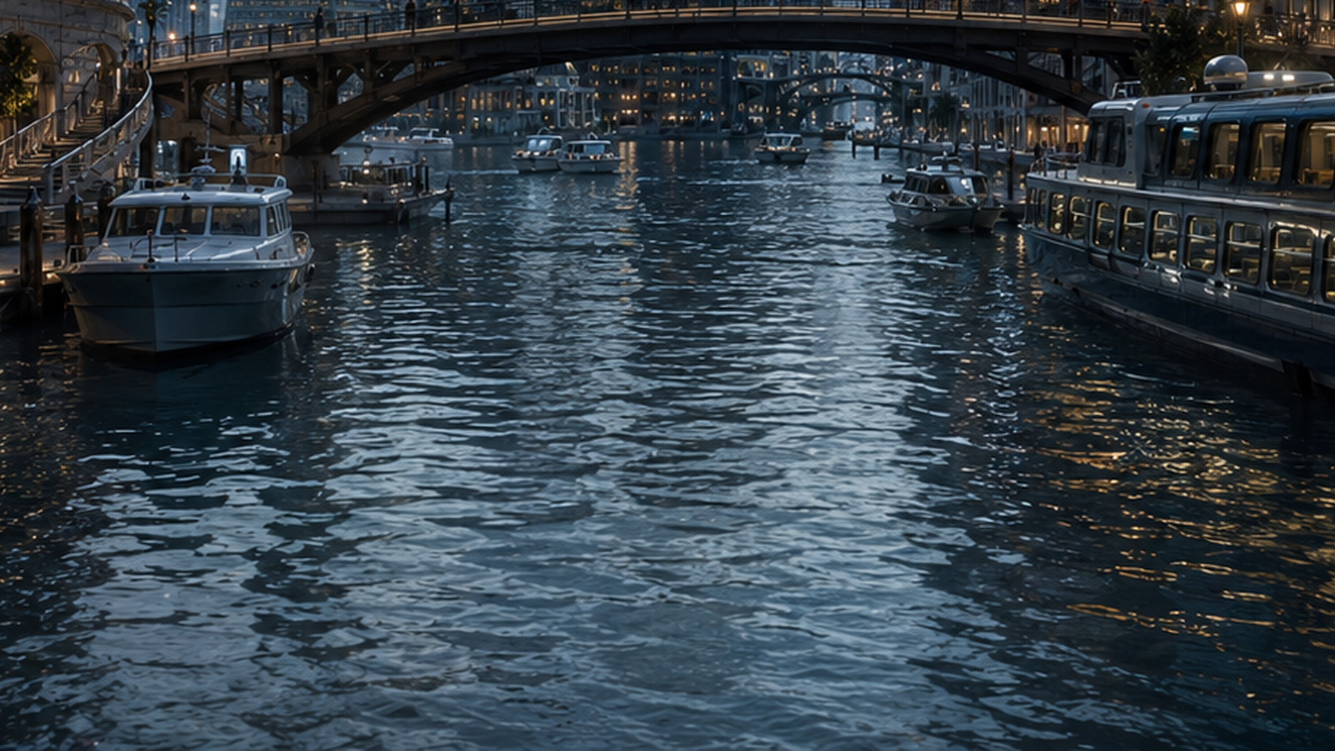
R24-31 / wet_reflections_04.jpg
1920 × 1080 · targeted 16:9 crop, resized to 1920x1080
dark rippled water with broken warm reflections, wakes and local highlights
Context and validation
The packet brief, CSV, annotations, entity map and original handoffs are retained. Historical v18–v25 evaluation scores and production targets are labeled as prior context. The current baseline is v48, retaining the dining barge, crane-yard ferry, underwater drone, flood gate and two-minute flight.
This is a reference discovery and planning deliverable. No Blender geometry, lighting or camera was changed. Proposed visual checks are described in the guide; they have not been run or passed.
Image inventory and hashes · Structured next-round plan · Original reference brief · Original reference metadata · Original entity map